Crake postdoctoral fellow Simeon Ehrlich presents his research on cities in late antiquity
Simeon Ehrlich, the 2017-18 Crake postdoctoral fellow, made a compelling case for rethinking how we categorize ancient cities at a talk he gave on Wednesday, March 28 in the Wu.
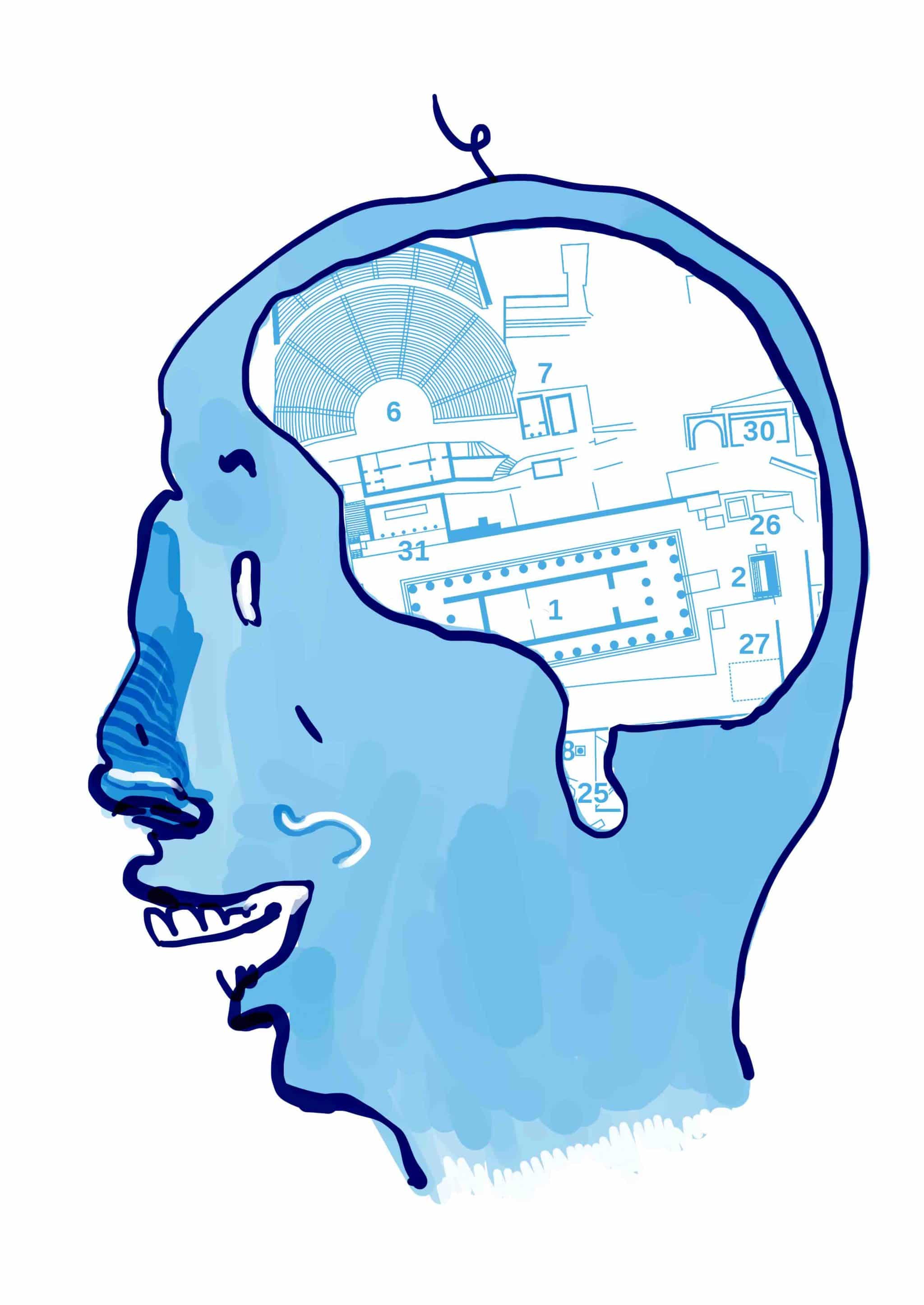
“The forms of cities themselves don’t necessarily tell us much about their organization. We need to look at the organizational patterns underlying these forms to see how these control and restrict access through the urban space,” he said, summarizing his doctoral research. “Just by looking at the plan of the city and the shapes we see, we don’t quite get a sense of that.” Ehrlich went on to describe how one can infer qualities of ancient cities, like the degree of central governance and the rigidity of social classes, by looking their layout.
He then presented the model he has developed for categorization. “We need to look beyond the forms to what underpins the forms,” he said, referring to organizational patterns, usages of barriers and road structures.
His model emphasizes three concepts. One is the definition of space. In other words, he considers the major repeating subunit of the city, whether it be a district, a block or an individual house.
Another concept is control of movement. Ehrlich considers how traffic can circulate around the city. If roads are highly organized and one is able to reach any road in the city from any other, the city likely possesses a high degree of central governance. If roads are arranged in an organic way, governance likely is delegated on more local levels.
“I was struck with how the Roman town plans were better engineered for evacuation in case of fire or other natural disaster than ‘tree-plan’ cities,” said Madeline McIntyre, a second-year French student.
The third concept is ease of access. This point relates to how physical barriers are distributed within a city. “You can get a sense of how the society divides people into different social strata,” said Ehrlich. He cited Pompeii as an example of a city that reflects the social mobility of its lower classes with the ease of travel throughout the city. He said, “We can definitely get a sense for the administration of the city based on what we see in the plan.”
When asked what interests him about the area of classical urban planning, he replied “I’ve always liked maps. I like the order of the plans. I was always interested in ancient science and mathematics.… My research led me away from that, but that’s how I got into it.”
“[The talk] completely blew away my previous assumptions on what defined Greco-Roman cities, which was something I hadn’t considered a lot beforehand,” said Pierre LeBlanc, a second-year history student.
Though the subject isn’t something most students consider often, Ehrlich demonstrated its importance in the field of classical archeology by showing his audience a whole new way to look at the ancient city and even the contemporary city. It proved to be an enlightening experience.